
Danville ZIP Code Coverage
Four postal codes appear in the Danville research. They do not divide the city into four civic districts. USPS assigns a delivery code to an address, while the city uses parcel and boundary information for municipal work. The careful reading is therefore modest: standard delivery is documented for 24540 and 24541, 24543 is a box-oriented postal use, and 24544 has been identified in federal and state mapping as a Danville City or unique and large-user designation. Exact current street coverage must still be checked through USPS.
| ZIP | Areas Covered | Post Office | Notes |
|---|---|---|---|
| 24540 | Standard-delivery Danville area, with central and urban addresses commonly using it | Danville postal delivery | Confirm each street. A ZIP line is not a neighborhood or city-limit line. |
| 24541 | Standard-delivery Danville area and broad city service area | Danville postal delivery | Federal and state tables identify Danville, but the exact street range belongs in the USPS result. |
| 24543 | Box-oriented Danville postal service | Danville post-office and PO Box use | A box ZIP does not identify where a person lives. |
| 24544 | Danville City postal designation in federal and state mapping | Current delivery or large-user details were not fully specified in reviewed pages | Treat as a postal designator, not a neighborhood. Verify by exact address. |
Do not turn the table into a roster of households. A delivery ZIP identifies mail routing, not a person’s presence at a property. It can also be older than a city’s current boundary or serve an address with a Danville postal name outside the city.
Danville ZIP Code USPS Check
The USPS ZIP Code Lookup is the delivery authority for a Danville address. Its By Address form uses Street Address, City, and State, with Company and Apt/Suite optional and ZIP optional. The same service also offers By City and State and Cities by ZIP. USPS cautions that a ZIP result does not confirm that a person or company is at an address, so use it to verify postal routing rather than identity.
The USPS lookup screen is shown in this official source capture.
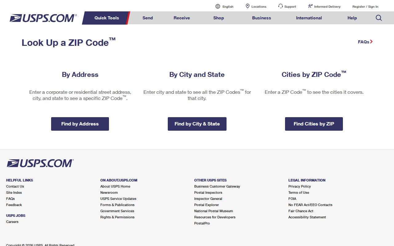
Its separate tabs support a disciplined check: record the recognized city and returned ZIP, then compare that postal answer with city parcel data instead of replacing one with the other.
| USPS mode | What to enter | Use in Danville |
|---|---|---|
| By Address | Street Address, City, State; optional unit and ZIP | Confirms the postal code for one delivery point. |
| By City and State | Both city and state | Lists postal-city results, not city-boundary evidence. |
| Cities by ZIP | ZIP | Checks the recognized city naming tied to a code. |
Note: Save the exact USPS wording with the search date because postal recognition can differ from the city’s parcel label.
Find a Danville ZIP Code
A ZIP-based question should begin with an address, not a broad claim that every property in a named area shares one code. Danville’s public parcel tools are valuable after USPS responds, because they preserve the parcel’s situs and tax-mailing fields. A complete search note can show which source supplied each value and prevents a postal label from being mistaken for an ownership or occupancy finding.
- Enter the complete street address in the USPS lookup and retain its recognized city and ZIP result.
- Open the same address in Danville MapInsights and record the parcel’s site address.
- Compare the parcel’s situs with its
mail4tax-mail field. Keep both when they differ. - Label the result as postal, municipal, or tax geography. Ask USPS or the assessor about a conflict instead of changing the record yourself.
Once a verified code narrows the question to a particular road, the Danville street directory handles the fuller address-by-address record trail.
Danville ZIP Code Parcel Fields
MapInsights supports address, owner, parcel-account, and advanced parcel searches, but the inspected public configuration does not document a user-facing ZIP filter. Its Parcel FeatureServer includes site_address and mail4, alongside owner, legal description, zoning, land-use, sale, and parcel fields. That makes a field comparison possible after an address search. It does not make the GIS system a USPS replacement or a promised ZIP-wide resident search.
The city parcel schema appears in this Danville GIS FeatureServer capture.
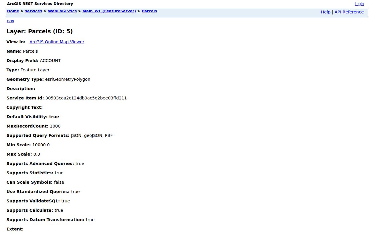
The available address, owner, land-use, and sale fields explain why GIS helps compare parcel information, while USPS remains the authority for the delivery ZIP.
| Danville GIS control or field | Available use | ZIP limitation |
|---|---|---|
| Search by Address | Contains match on site address | No documented ZIP search. |
| Owner and Parcel Account ID | Find a parcel record or tax-owner string | Neither proves delivery ZIP or occupancy. |
site_address and mail4 | Compare situs with tax mailing data | Fields can differ and are not a neighborhood classifier. |
| Legal, zoning, sale, land use | Refine parcel context | Not postal search controls. |
Danville ZIP Code 24543
24543 deserves a separate warning because the research identifies it with Danville PO Box and box-oriented service. A public record may carry a mailing address for tax, safety, or correspondence reasons. That address should not be converted into a residence, a parcel location, or a neighborhood assignment. The parcel’s site address and the recorded legal description answer different questions.
- ZIP code
- A postal routing code assigned by USPS to an address or mail service.
- ZIP+4
- An added four-digit delivery detail that narrows mail handling below the basic five-digit ZIP.
- PO Box ZIP
- A code used for post-office boxes. It identifies the mail service, not a home location.
- Unique ZIP
- A postal designation for a high-volume or specialized recipient. It is not a neighborhood boundary.
- Carrier route
- A mail-delivery route used inside postal operations. It is not a city political or census area.
Note: When a record has only a box address, preserve that limitation rather than inferring a Danville street location.
Danville ZIP Code Geography
ZIP boundaries, city limits, and neighborhood names are three different maps. Danville is an independent city, while nearby Pittsylvania County has separate jurisdiction and can share a Danville postal label. A city address may also use a PO Box or unique code. For municipal records, the city line and the responsible office matter more than the postal city printed on an envelope.
The city strategy material names 62 neighborhoods, 15 census tracts, and 37 block groups. Those civic geographies do not neatly convert into ZIP totals. No official ZIP population or voter totals were found, so a ZIP code directory should not invent them.
Danville ZIP Code Voter Limits
The Virginia voter information portal is a self-service status tool, not an anonymous ZIP roster. A voter-list request follows Virginia election procedures and can use locality, election district, and other listed filters, but the inspected form does not document a ZIP filter. Public-list rules under Va. Code §24.2-444 also exclude protected information.
For a lawful question involving an address, use Danville locality data and the applicable request process. Protected voters, substitute addresses, full Social Security numbers, and day and month of birth are not public block data. The search does not reveal votes or party registration, since Virginia does not register voters by party.
Danville ZIP Code History
Modern ZIP codes do not solve an old-address question by themselves. North Danville and Neapolis were annexed in 1896, and the 1887 Turner directory combined Danville and North Danville in its title. For a nineteenth-century property, retain the historic locality name, printed street spelling, deed legal description, and current USPS result as separate pieces of evidence.
Virginia Sanborn map guidance helps align the listed Danville map years from 1886 through 1954 with a modern parcel. A map can show a building footprint and street context, but it cannot establish ownership or a current delivery code.
Danville ZIP Code Record Notes
Keep a short source log for every Danville ZIP code check: the exact address submitted, USPS result, parcel account if found, site address, mailing field, search date, and jurisdiction. The City Assessor maintains current ownership and mailing information, while the city GIS supplies map and parcel context. Neither source should be stretched into a full household directory.
If a record seems to cross the city line, start a separate Pittsylvania County search instead of filing it as a Danville city record. The correct jurisdiction is more useful than a neat but inaccurate ZIP grouping.
Danville’s public GIS offers more than a map window. Its public site describes parcel, address, building, zoning, street-name, house-number, parcel-number, points-of-interest, and district context, and its Data Hub has downloadable layers. Those layers can help identify the municipal context of a verified address. They should be used after, not instead of, the USPS postal check. A broad ZIP scan from GIS fields would require a permitted query or export and local filtering under the service rules; the reviewed public interface did not offer that as a reader-facing search.
When the service, a parcel card, and USPS do not agree, preserve all returned values. The city’s GIS support route can clarify map data, while USPS can clarify delivery assignment. A short discrepancy note protects the historical and municipal record from a false “correction.”